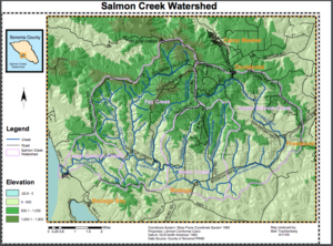
Salmon Creek is an 18.3-mile-long stream in western Sonoma County, CA that springs from coastal hills west of the town of Occidental and empties into the Pacific Ocean north of Bodega Head.
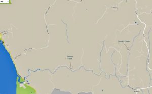
Salmon Creek originates about 2 miles west of Occidental near the junction of Joy Road and Bittner Road. It parallels Bittner Road eastward, passing just south of Occidental, where it turns right and follows Bohemian Highway to the town of Freestone. From there, it curves south and then west, passing Watson School historic park as it parallels Bodega Highway to a confluence with Nolan Creek just east of the town of Bodega. It flows through Bodega, then follows Salmon Creek Road westward into a narrow canyon, where it is joined by Tannery Creek, Fay Creek, Coleman Valley Creek, and Finley Creek. Salmon Creek emerges from the canyon between Irish Hill and Coleman Hill and crosses Highway 1 at milepost 12.49, entering Sonoma Coast State Beach south of the ranger station. It parallels Bean Avenue to Salmon Creek Beach, which it bisects as it enters the Pacific Ocean.
For a downloadable (pdf) version of the following map of the Salmon Creek Watershed, click here.